News Summary
Severe thunderstorm warnings have been issued for Spartanburg County as the National Weather Service alerts residents of impending storms. The warning predicts gusty winds, heavy rain, and a high risk of lightning. Residents are advised to seek shelter indoors and stay away from windows to ensure their safety. This serves as a critical reminder of the dangers posed by thunderstorms during this period of severe weather activity.
Spartanburg County Faces Severe Thunderstorm Warnings
The National Weather Service (NWS) Greenville-Spartanburg issued a weather alert for Spartanburg County on Friday at 4:44 p.m. due to the imminent threat of strong thunderstorms. This alert is effective until 5:15 p.m., and residents are urged to be cautious as wind gusts could reach up to 40 miles per hour.
At the time of the alert, Doppler radar indicated a strong thunderstorm located 13 miles south of Columbus, approximately 4 miles west of Inman, moving southeast at a speed of 20 mph. Residents in the towns of Inman, Lyman, and Lake Bowen are directly affected by this alert. The NWS has advised anyone outside to seek shelter indoors promptly.
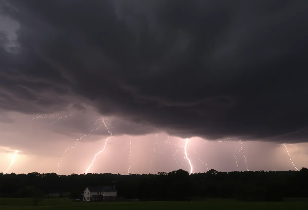
Threats Posed by Severe Weather
The forecasted storm conditions could lead to gusty winds that may down tree limbs or push around unsecured items. Additionally, lightning is a significant concern with thunderstorms. About 25 million lightning strikes hit the U.S. every year, causing around 20 fatalities primarily during the summer months. The risk of being struck by lightning increases as a thunderstorm approaches, peaking when it is directly overhead.
Safety recommendations for residents during thunderstorms include finding shelter indoors or utilizing hard-topped vehicles if seeking indoor refuge is not an option. Staying away from windows and doors and avoiding the use of wired electronics are also best practices during such weather.
Previous Weather Alerts
On Thursday, at 3:51 p.m., the NWS issued another weather alert for thunderstorms and heavy rain in Spartanburg County, valid until 4:30 p.m. This alert highlighted thunderstorms with heavy rainfall stretching from 5 miles southeast of Columbus to 16 miles southwest of Spartanburg, moving eastward at 30 mph. Residents were similarly advised to remain indoors during this time.
Moreover, a severe thunderstorm warning was previously issued on Monday, July 28, at 4:17 p.m. for central Spartanburg County until 4:45 p.m. That storm warning predicted wind gusts reaching up to 60 mph and hail measuring an inch in diameter. Affected areas included Roebuck, Moore, Pauline, Croft State Park, and Spartanburg.
Continuing Weather Patterns
The severe weather watch remains active until midnight, affecting multiple counties in the vicinity. A storm timeline indicates that severe weather is expected to reach Oconee and Anderson counties by 7 p.m., the Greenville area by 8 p.m., and Spartanburg by 9 p.m. After 7 p.m., showers may continue with a chance of isolated thunderstorms.
Upcoming Weather Outlook
Following the severe weather, Saturday’s forecast suggests highs around 60 degrees, with temperatures warming up to approximately 70 degrees by Sunday. Early next week, residents can anticipate temperatures nearing 80 degrees accompanied by predominantly sunny conditions.
The NWS encourages residents to report any incidents of damaging winds, hail, or flooding by contacting their toll-free number or via social media, ensuring vital information on weather patterns and impacts is shared effectively within the community.
Deeper Dive: News & Info About This Topic
HERE Resources
Cooling Centers Open in Upstate South Carolina Amid Heat Wave
Extreme Heatwave Engulfs Eastern U.S.
South Carolina Faces Extreme Heat and Weather Warnings
Severe Thunderstorms Lead to Widespread Power Outages in Lowcountry
Severe Thunderstorms Cause Damage in Spartanburg and Union
Severe Weather Impacts Millions Across the U.S. This Weekend
Severe Flash Flooding Devastates Texas Hill Country
Snow Flurries Hit Upstate South Carolina with Winter Hazards
Lightning Strike Injures 20 at Lake Murray Beach
Severe Thunderstorm Alert Issued for Greenville and Spartanburg
Additional Resources
- GoUpstate: Spartanburg County Severe Thunderstorm Warning
- Wikipedia: Thunderstorm
- The State: Weather News
- Google Search: Thunderstorm Safety
- WYFF4: Severe Weather Timing
- Google Scholar: Severe Weather Alerts
- Myrtle Beach Online: Weather News
- Encyclopedia Britannica: Thunderstorm

Author: STAFF HERE SPARTANBURG
The SPARTANBURG STAFF WRITER represents the experienced team at HERESpartanburg.com, your go-to source for actionable local news and information in Spartanburg, Spartanburg County, and beyond. Specializing in "news you can use," we cover essential topics like product reviews for personal and business needs, local business directories, politics, real estate trends, neighborhood insights, and state news affecting the area—with deep expertise drawn from years of dedicated reporting and strong community input, including local press releases and business updates. We deliver top reporting on high-value events such as the Spartanburg International Festival, Spartanburg ArtWalk, and motorsport events at Spartanburg Speedway. Our coverage extends to key organizations like the Spartanburg Area Chamber of Commerce and the Spartanburg Regional Healthcare System Foundation, plus leading businesses in manufacturing and textiles that power the local economy such as BMW Manufacturing and Milliken & Company. As part of the broader HERE network, including HEREAiken.com, HEREBeaufort.com, HEREChapin.com, HERECharleston.com, HEREClinton.com, HEREColumbia.com, HEREGeorgetown.com, HEREGreenwood.com, HEREGreenville.com, HEREHiltonHead.com, HEREIrmo.com, HEREMyrtleBeach.com, HERENewberry.com, HERERockHill.com, and HERESpartanburg.com, we provide comprehensive, credible insights into South Carolina's dynamic landscape.