News Summary
The National Weather Service has issued a weather alert for Union and Spartanburg counties due to strong thunderstorms. Residents should expect pea-sized hail and wind gusts up to 40 mph. The storm, moving east at 15 mph, poses risks such as falling tree limbs and lightning strikes. Safety precautions are advised, including seeking shelter indoors. Additionally, previous alerts for dense fog and severe thunderstorms highlight the need for vigilance. Residents are urged to stay informed about ongoing weather conditions.
Union, South Carolina – The National Weather Service (NWS) in Greenville-Spartanburg issued a weather alert on Saturday at 3:12 p.m. for Union and Spartanburg counties, indicating the presence of strong thunderstorms until 3:45 p.m. Residents are advised to take precautions as the storms are expected to bring pea-sized hail measuring 0.25 inches and wind gusts that could reach up to 40 mph.
According to Doppler radar data, at the time of the alert, a significant thunderstorm was located about 14 miles northeast of Laurens and 8 miles southeast of Woodruff, moving east at a speed of 15 mph. The NWS warned that the gusty winds associated with the storm could potentially knock down tree limbs and blow unsecured objects around, posing further hazards.
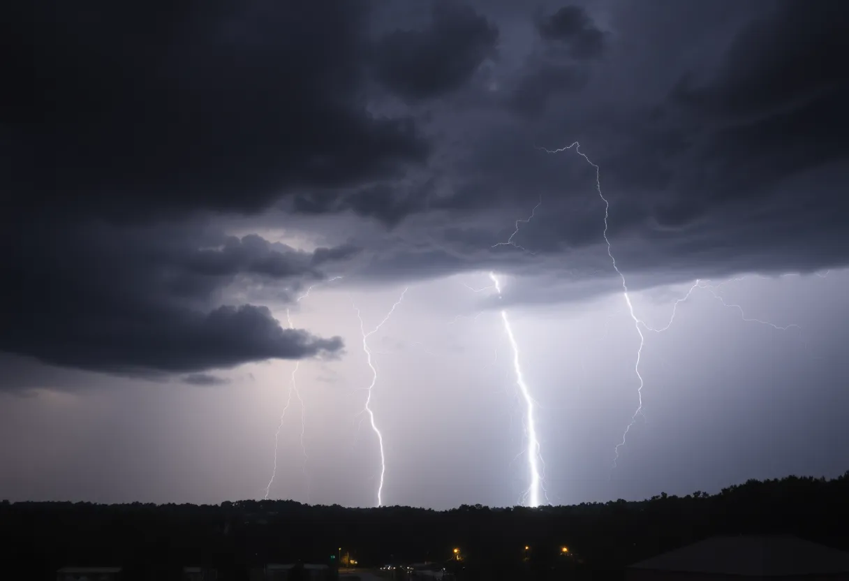
The alert is specifically relevant to the communities of Enoree and Cross Anchor. With the possibility of minor hail damage to outdoor items, residents are urged to seek shelter indoors if they are outside when the storm approaches. The threat from thunderstorms escalates with the approach of lightning, which strikes the United States about 25 million times annually, leading to around 20 fatalities each year.
The chances of lightning flare up as a thunderstorm draws near and peak when the storm is directly overhead, diminishing as it moves away from the area. Hence, the NWS recommends that people follow proper thunderstorm safety protocols by remaining indoors until the weather improves. Another caution pertains to hydroplaning, which occurs when vehicles slide uncontrollably on wet roads. This situation arises when water gathers in front of tires faster than the vehicle’s weight can disperse it.
In addition to the thunderstorm alert, the NWS previously issued a special weather statement on Friday at 4:52 a.m., valid until 10 a.m., for Greenville and Spartanburg counties due to areas of dense fog. Visibility in some locations dropped below one mile, with isolated areas reporting visibility as low as one-fourth of a mile. Commuters in the area were cautioned about the sudden visibility drops that could create dangerous driving conditions during the morning hours.
The Fri-day alert follows a severe thunderstorm warning issued on Thursday, July 10, at 4:51 p.m. for Cherokee and Spartanburg counties. This warning forecasted winds of up to 60 mph and hail stones as large as one inch. By that time, the storm was noted to be approximately 7 miles northeast of Spartanburg, near Cowpens, and moving east at a speed of 10 mph. Areas impacted included Spartanburg, Cowpens, Mayo, Pacolet Mills, Cedar Springs, and Thicketty, among others.
Shortly thereafter, at 8:12 p.m. on June 17, an additional severe thunderstorm warning was issued for several counties, including Elbert and Hart in Georgia, along with multiple counties in South Carolina. Similar concerns regarding strong winds and hail were also present in this warning. Affected areas in South Carolina during that alert included Greenville Downtown, Anderson, Easley, and Clemson.
The series of severe thunderstorm alerts emphasizes the critical importance of taking immediate shelter when storms are detected. Residents are encouraged to stay informed about weather conditions and report any significant weather-related incidents to local authorities.
Deeper Dive: News & Info About This Topic
HERE Resources
Hurricane Kiko Approaches Hawaii as a Category 4 Storm
Driver Dies in Tragic Union County Vehicle Crash
Massive Haboob Dust Storm Hits Arizona – Visibility Reduced
North Carolina’s Outer Banks Faces Erosion and Home Crises
Hurricane Erin Strengthens to Category 4, Threatening the U.S. East Coast
Severe Thunderstorms Cause Damage and Outages in Spartanburg
Flash Floods Devastate Northern China
Severe Thunderstorm Alerts Issued for Upstate South Carolina
Severe Thunderstorm Warning Issued for Greenville and Spartanburg Counties
Alaska Governor Declares Disaster Due to Flooding Threat
Additional Resources
- Island Packet
- Wikipedia: Thunderstorm
- The State
- Google Search: Thunderstorm Precautions
- Greenville Online
- Google Scholar: Severe Thunderstorm Warnings
- Myrtle Beach Online
- Encyclopedia Britannica: Thunderstorm
- Fox Carolina
- Google News: Severe Storms Damage

Author: STAFF HERE SPARTANBURG
The SPARTANBURG STAFF WRITER represents the experienced team at HERESpartanburg.com, your go-to source for actionable local news and information in Spartanburg, Spartanburg County, and beyond. Specializing in "news you can use," we cover essential topics like product reviews for personal and business needs, local business directories, politics, real estate trends, neighborhood insights, and state news affecting the area—with deep expertise drawn from years of dedicated reporting and strong community input, including local press releases and business updates. We deliver top reporting on high-value events such as the Spartanburg International Festival, Spartanburg ArtWalk, and motorsport events at Spartanburg Speedway. Our coverage extends to key organizations like the Spartanburg Area Chamber of Commerce and the Spartanburg Regional Healthcare System Foundation, plus leading businesses in manufacturing and textiles that power the local economy such as BMW Manufacturing and Milliken & Company. As part of the broader HERE network, including HEREAiken.com, HEREBeaufort.com, HEREChapin.com, HERECharleston.com, HEREClinton.com, HEREColumbia.com, HEREGeorgetown.com, HEREGreenwood.com, HEREGreenville.com, HEREHiltonHead.com, HEREIrmo.com, HEREMyrtleBeach.com, HERENewberry.com, HERERockHill.com, and HERESpartanburg.com, we provide comprehensive, credible insights into South Carolina's dynamic landscape.