News Summary
The National Weather Service has issued a Severe Thunderstorm Warning for Cherokee and Spartanburg counties, effective until 7:30 p.m. Residents should brace for wind gusts up to 40 mph as thunderstorms move in. Communities at risk include Chesnee, Cowpens National Battlefield, and Mayo. Safety precautions recommend seeking indoor shelter and avoiding electrical devices during the storm. Drivers are also advised to be cautious of hydroplaning, prompted by wet conditions. Staying informed about this weather threat is crucial for personal safety.
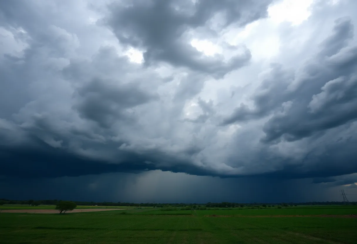
Cherokee and Spartanburg Counties Under Severe Thunderstorm Warning
The National Weather Service (NWS) Greenville-Spartanburg SC has issued a Severe Thunderstorm Warning for Cherokee and Spartanburg counties, effective until 7:30 p.m. on Sunday evening. Residents in the affected areas are advised to prepare for wind gusts reaching up to 40 mph as strong thunderstorms approach.
At 6:58 p.m., Doppler radar identified a robust thunderstorm approximately 9 miles south of Forest City, near Chesnee, moving east at a speed of 15 mph. The gusty winds associated with this weather system could lead to fallen tree limbs and the movement of unsecured objects.
Areas Affected
Communities experiencing the impact of this storm include Chesnee, Cowpens National Battlefield, Mayo, Cliffside, Henrietta, Harris, and Caroleen. With severe weather conditions imminent, the NWS recommends that anyone outdoors should seek shelter indoors to ensure personal safety.
Understanding Thunderstorms
Thunderstorms are common natural phenomena, especially during the summer months. Each year, the United States experiences around 25 million lightning strikes, leading to an average of 20 fatalities linked to lightning. As a thunderstorm approaches, the likelihood of lightning increases, reaching its peak when the storm is overhead before diminishing once the storm passes.
Safety Precautions During Thunderstorms
For those who are unable to find shelter indoors during a thunderstorm, the NWS offers several safety recommendations. One of the critical safety tips is to avoid staying outside during severe weather. If indoors, it is best to stay away from windows and doors and avoid using electrical appliances, as they can be hazardous during a lightning strike.
Driving Safety Considerations
In addition to personal safety during thunderstorms, the NWS emphasizes the importance of safe driving practices in wet conditions. One significant hazard is hydroplaning, a situation in which a vehicle begins to slide uncontrollably on wet roads. This occurs due to water pressure preventing tires from maintaining contact with the road surface.
Causes of Hydroplaning
Several factors can contribute to hydroplaning, including:
- Water depth: A greater water depth increases the risk of losing tire traction.
- Tire tread depth: Worn tires are less effective in dispersing water and are more prone to hydroplaning.
- Speed of the vehicle: Higher speeds during wet conditions make hydroplaning more likely.
Drivers should be aware of the necessary steps to regain control of a vehicle if they begin to hydroplane. Reducing speed and gently steering the vehicle in the direction of travel can help to regain traction and control.
Conclusion
As the severe thunderstorm warning remains active until 7:30 p.m. local time, residents of Cherokee and Spartanburg counties are urged to stay informed about the weather conditions and take appropriate precautions to ensure their safety during this weather event.
Deeper Dive: News & Info About This Topic
HERE Resources
Severe Thunderstorm Warning Issued for Greenville and Spartanburg
Severe Thunderstorm Alert Issued for Spartanburg County
Severe Weather Action in Texas as Emergency Resources Mobilized
Severe Thunderstorm Warning for Greenville and Spartanburg
Wofford College Hosts Civil Discourse Event
Severe Thunderstorm Warning Issued for Upstate South Carolina
Severe Thunderstorm Warning Issued for Greenville and Spartanburg
Multiple Crashes Cause Major Traffic Delays on I-85 in Spartanburg County
Wofford College President Nayef Samhat to Step Down
Wofford College Achieves Outstanding APR Results
Additional Resources
- Island Packet: Severe Thunderstorm Warning
- Wikipedia: Thunderstorm
- Post and Courier: Spartanburg Thunderstorm
- Google Search: Thunderstorm Safety Tips
- Island Packet: Weather Update
- Google Scholar: Thunderstorm Hydroplaning
- The State: Weather Advisory
- Encyclopedia Britannica: Thunderstorm
- Greenville Online: Weather Alert

Author: STAFF HERE SPARTANBURG
The SPARTANBURG STAFF WRITER represents the experienced team at HERESpartanburg.com, your go-to source for actionable local news and information in Spartanburg, Spartanburg County, and beyond. Specializing in "news you can use," we cover essential topics like product reviews for personal and business needs, local business directories, politics, real estate trends, neighborhood insights, and state news affecting the area—with deep expertise drawn from years of dedicated reporting and strong community input, including local press releases and business updates. We deliver top reporting on high-value events such as the Spartanburg International Festival, Spartanburg ArtWalk, and motorsport events at Spartanburg Speedway. Our coverage extends to key organizations like the Spartanburg Area Chamber of Commerce and the Spartanburg Regional Healthcare System Foundation, plus leading businesses in manufacturing and textiles that power the local economy such as BMW Manufacturing and Milliken & Company. As part of the broader HERE network, including HEREAiken.com, HEREBeaufort.com, HEREChapin.com, HERECharleston.com, HEREClinton.com, HEREColumbia.com, HEREGeorgetown.com, HEREGreenwood.com, HEREGreenville.com, HEREHiltonHead.com, HEREIrmo.com, HEREMyrtleBeach.com, HERENewberry.com, HERERockHill.com, and HERESpartanburg.com, we provide comprehensive, credible insights into South Carolina's dynamic landscape.