News Summary
Spartanburg County, SC, is currently under severe thunderstorm warnings as issued by the National Weather Service. Strong thunderstorms are expected with wind gusts up to 60 mph and hail potential. Residents are advised to seek shelter indoors to ensure safety from possible hail damage and downed tree limbs. Additional warnings have been issued for various locations throughout the county, emphasizing the need for residents to remain vigilant and adhere to safety recommendations.
Spartanburg County, SC is currently under severe thunderstorm warnings, updated by the National Weather Service (NWS) during the late afternoon on Thursday. The warning was issued at 4:41 p.m. for strong thunderstorms expected to affect the area until 5:15 p.m., with significant weather phenomena such as pea-sized hail and wind gusts of up to 40 mph anticipated.
As of 4:40 p.m., Doppler radar detected a robust thunderstorm located approximately 5 miles northeast of Spartanburg and 4 miles west of Cowpens, moving eastward at a slow pace of 5 mph. The NWS has cautioned that the gusty winds accompanying this storm might uproot tree limbs and displace unsecured outdoor items, along with causing minor hail damage.
The severe thunderstorm warning impacts several locations, including Spartanburg, Cowpens, Cedar Springs, and Mayo. Residents are advised to seek shelter indoors, especially if they are outdoors, due to the potential for torrential rainfall that could result in localized flooding.
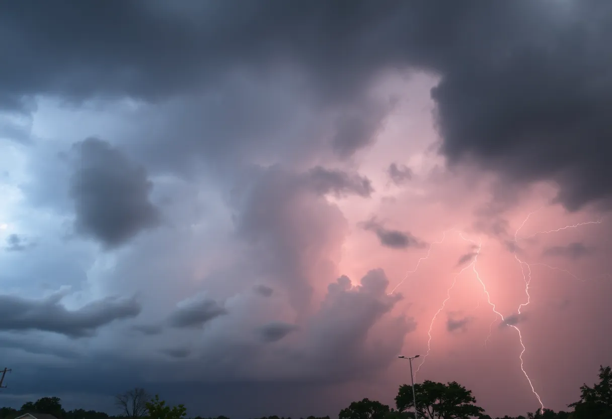
The length of the warning highlights the storm’s intensity; it remains effective until 5:15 p.m. During severe thunderstorms, the risk of lightning strikes also escalates. The NWS estimates there are around 25 million lightning strikes in the United States each year, primarily occurring in the summer, with about 20 fatalities associated with these strikes annually.
Thunderstorm safety recommendations from the NWS indicate individuals should move indoors during storms and avoid driving through flooded roadways as conditions may lead to hydroplaning. It is crucial to remain vigilant as the thunderstorm develops, particularly as the chance of lightning strikes peaks when storms are overhead.
Adding to the severe weather concerns, another severe thunderstorm warning was issued on Friday, July 11, at 6:03 p.m., set to last until 7 p.m. This storm is anticipated to bring wind gusts of up to 60 mph and hail the size of quarters, approximately 1 inch in diameter.
At the time of the warning, a severe thunderstorm was tracked near either Spartanburg or Cedar Springs, moving in a southeast direction at 10 mph. The potential impacts of this storm include minor hail damage to vehicles and the possibility of wind-related damage to trees and power lines. Areas affected by this warning include Spartanburg, Pacolet, Pacolet Mills, Croft State Park, Cedar Springs, and Pauline.
The NWS stresses the importance of safety measures during these storms, recommending that individuals relocate to an interior room on the lowest floor of their homes or buildings to minimize risk during severe weather events.
A severe thunderstorm warning indicates that the area is experiencing conditions with winds of 58 mph or higher or hail measuring one inch or larger in diameter, underlining the significance of heeding such warnings for personal safety.
Residents and visitors in Spartanburg County are encouraged to stay informed and take appropriate precautions as the weather develops. Monitoring local weather resources and adhering to safety guidelines can significantly mitigate risks associated with severe thunderstorms.
Deeper Dive: News & Info About This Topic
HERE Resources
Lightning Strike Injures 20 People at Lake Murray Public Park
Severe Thunderstorm Warning Issued for Spartanburg Area
Severe Thunderstorm Warning Issued for Spartanburg, SC
Historic Flash Flooding Hits Multiple States
Wildfires Spark Evacuations Across North and South Carolina
Historic Flash Flooding in Ruidoso, New Mexico Claims Lives and Causes Destruction
Bright Fireball Lights Up North Carolina Sky
South Carolina Faces Wildfire Crisis as State of Emergency Declared
Snow Flurries Hit Upstate South Carolina with Winter Hazards
Devastating Floods Hit Central Texas, Claiming Lives
Additional Resources
- GoUpstate
- Wikipedia: Thunderstorm
- The State
- Google Search: Severe Thunderstorms
- Island Packet
- Google Scholar: Thunderstorm Warnings
- Post and Courier
- Encyclopedia Britannica: Thunderstorm